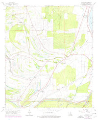
1963 Map of Lake Bruin
USGS Topo · Published 1977About this map
Thistle Ridge Plantation and Mound Plantation characterize the alluvial landscape of Tensas Parish in the 1960s, where agricultural heritage meets the complex hydrology of the Mississippi River floodplain. This survey captures a region defined by its oxbow lakes and winding waterways, notably Lake Bruin and St Peter Lake, which are bordered by an extensive system of levees. The local economy and social structure are reflected in the numerous small settlements and religious sites, such as Crimea and Locust Ridge, alongside several community landmarks like Mound Hebrew Ch and China Grove Ch. The presence of the Missouri Pacific railroad and the Lancing Strip indicate the importance of transportation and early aviation in this river-bound territory, while scattered oil wells point to the subsurface resources being tapped during this era.
Find a feature on this map
58 named features on this map. Tap any name to fly to it.
Don’t see what you’re looking for? This feature index may not catch every label — zoom into the map to look around manually.
Map Details
Editions of this 1963 Lake Bruin Map
2 editions found
Other maps of this area

1909 · Delta Bridge
USGS Topo · 1:24,000

1909 · Lake Bruen
USGS Topo · 1:24,000

1935 · Shackleford Lake
USGS Topo · 1:62,500

1939 · Lorman
USGS Topo · 1:62,500

1939 · Locust Ridge
USGS Topo · 1:62,500

1953 · Natchez
USGS Topo · 1:250,000

1955 · Jackson
USGS Topo · 1:250,000

1956 · Natchez
USGS Topo · 1:250,000

1958 · Shackleford Lake
USGS Topo · 1:62,500

1958 · St. Joseph
USGS Topo · 1:62,500