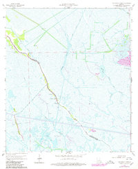
1964 Map of Lake Bully Camp
USGS Topo · Published 1980About this map
Bayou Pointe au Chien serves as the primary artery for settlement and movement in this marshy landscape along the boundary of Lafourche Parish and Terrebonne Parish. The ribbon of higher ground flanking the bayou hosts the local community, evidenced by Live Oak Ch, St Peters Ch, and the Lower Pointe au Chien Sch. These structures represent the social center of a region where life is dictated by the water, with numerous canals like the St Louis Canal and Viguerie Canal cutting through the wetlands.
Find a feature on this map
21 named features on this map. Tap any name to fly to it.
Don’t see what you’re looking for? This feature index may not catch every label — zoom into the map to look around manually.
Map Details
Editions of this 1964 Lake Bully Camp Map
4 editions found
Other maps of this area

1892 · Cut-Off
USGS Topo · 1:62,500

1892 · Houma
USGS Topo · 1:62,500

1894 · Lake Felicity
USGS Topo · 1:62,500

1894 · Dulac
USGS Topo · 1:62,500

1932 · Houma SE
USGS Topo · 1:31,680

1935 · Bourbeux
USGS Topo · 1:31,680

1935 · Viguerie Canal
USGS Topo · 1:31,680

1935 · Montegut
USGS Topo · 1:31,680

1935 · Bay Courant
USGS Topo · 1:31,680

1935 · Golden Meadow
USGS Topo · 1:31,680