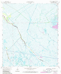
1964 Map of Lake Bully Camp
USGS Topo · Published 1986About this map
Bayou Pointe au Chien serves as the primary artery for settlement in this coastal marshland straddling the border of Lafourche and Terrebonne Parishes. The 1960s landscape shows a tight-knit community clustered along the natural levees of the bayou, anchored by local institutions like St Peters Ch, Live Oak Ch, and the Lower Pointe au Chien Sch. Away from the narrow corridor of dry land, the environment is dominated by an intricate network of waterways including the Grand Bayou Canal and St Jean Charles Canal. The economic character of the region is defined by extensive energy extraction, with the Bully Camp Gas and Oil Field and Bayou Jean Lacroix Oil and Gas Field carving industrial footprints into the surrounding wetlands and reaching toward Lake Bully Camp.
Find a feature on this map
16 named features on this map. Tap any name to fly to it.
Don’t see what you’re looking for? This feature index may not catch every label — zoom into the map to look around manually.
Map Details
Editions of this 1964 Lake Bully Camp Map
4 editions found
Other maps of this area

1892 · Cut-Off
USGS Topo · 1:62,500

1892 · Houma
USGS Topo · 1:62,500

1894 · Lake Felicity
USGS Topo · 1:62,500

1894 · Dulac
USGS Topo · 1:62,500

1932 · Houma SE
USGS Topo · 1:31,680

1935 · Bourbeux
USGS Topo · 1:31,680

1935 · Viguerie Canal
USGS Topo · 1:31,680

1935 · Montegut
USGS Topo · 1:31,680

1935 · Bay Courant
USGS Topo · 1:31,680

1935 · Golden Meadow
USGS Topo · 1:31,680