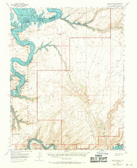
1953 Map of Lake Canyon
USGS Topo · Published 1970About this map
The confluence of the Colorado River and the San Juan River defines this landscape, captured during the early years of the reservoir's formation. Much of the terrain falls within the Glen Canyon National Recreation Area, where rising waters had begun to fill deep sandstone gorges like Moki Canyon and Lake Canyon. To the south, the boundary of the Navajo Indian Reservation stretches across high desert plateaus, including Wilson Mesa and Grey Mesa. The map reflects a transition from river-bottom geography to the emerging shoreline of Lake Powell, while inland features such as Nokai Dome and the namesake Johnnies Hole remain as fixed landmarks. Sparse infrastructure, limited to isolated Wells and an Oil Well, underscores the area's remote character and focus on mineral exploration and emerging water-based recreation.
Find a feature on this map
19 named features on this map. Tap any name to fly to it.
Don’t see what you’re looking for? This feature index may not catch every label — zoom into the map to look around manually.
Map Details
Editions of this 1953 Lake Canyon Map
3 editions found
Other maps of this area

1886 · Henry Mountains
USGS Topo · 1:250,000

1892 · Henry Mountains
USGS Topo · 1:250,000

1952 · Mancos Mesa
USGS Topo · 1:62,500

1952 · Clay Hills 3 NW
USGS Topo · 1:24,000

1952 · Navajo Mountain 4 NE
USGS Topo · 1:24,000

1952 · Oljeto
USGS Topo · 1:62,500

1953 · Navajo Mountain 4 NW
USGS Topo · 1:24,000

1953 · The Rincon
USGS Topo · 1:62,500

1953 · Lake Canyon
USGS Topo · 1:62,500

1953 · Mt. Ellsworth
USGS Topo · 1:62,500