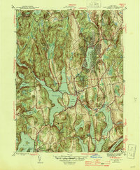
1944 Map of Lake Carmel
USGS Topo · Published 1944About this map
Carmel and its surrounding hill country in the mid-1940s are defined by an extensive system of reservoirs and water bodies including West Branch Reservoir and Croton Falls Reservoir. This topographical survey illustrates a landscape of early recreational retreats like Gipsy Trail Camp and Camp Brady set against the older agrarian and industrial bones of the county. The historic Tilly Foster Mine stands as a prominent industrial landmark near the Middle Branch Reservoir, while Drew Seminary overlooks the waters of Lake Gleneida. Transportation through the region is anchored by the New York Central railroad, which threads between the peaks of Smalley Mtn and Mount Pisgah, connecting rural settlements such as Farmers Mills, Crafts, and Deans Corners.
Find a feature on this map
52 named features on this map. Tap any name to fly to it.
Don’t see what you’re looking for? This feature index may not catch every label — zoom into the map to look around manually.
Map Details
Editions of this 1944 Lake Carmel Map
2 editions found
Other maps of this area

1892 · West Point
USGS Topo · 1:62,500

1892 · Carmel
USGS Topo · 1:62,500

1893 · Carmel
USGS Topo · 1:62,500

1893 · Clove
USGS Topo · 1:62,500

1893 · Poughkeepsie
USGS Topo · 1:62,500

1894 · West Point
USGS Topo · 1:62,500

1894 · Clove
USGS Topo · 1:62,500

1894 · Carmel
USGS Topo · 1:62,500

1894 · Poughkeepsie
USGS Topo · 1:62,500

1898 · Clove
USGS Topo · 1:62,500