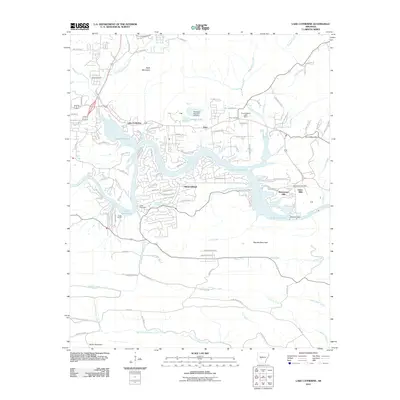
2011 Map of Lake Catherine
USGS Topo · Published 2011About this map
Lake Catherine serves as the central focal point for this region southeast of Hot Springs, formed by the winding Ouachita River. By the early 21st century, the shoreline had become heavily subdivided with residential developments like Diamondhead and Shorewood Hills, while maintaining recreational landmarks such as Camp Couchdale and Camp Tanako. The map illustrates the sophisticated water management infrastructure of the era, including the Remmel Dam and the Crouchwood Lake Dam, which regulate the river's flow through the gaps of Narrow Mountain and Cook Mountain. Evidence of the area's industrial past and local genealogy remains visible through labels for the Jones Mills Post Office and the Jones Mills settlement, as well as the Price Cemetery and Irwin Cemetery. The northern landscape is defined by the heights of Bald Mountain, while the southern reaches transition into the drainage basins of North Fork Blakely Creek and Jackson Creek.
Find a feature on this map
110 named features on this map. Tap any name to fly to it.
Don’t see what you’re looking for? This feature index may not catch every label — zoom into the map to look around manually.
Map Details
Editions of this 2011 Lake Catherine Map
This is the sole edition of this map. No revisions or reprints were ever made.
Other maps of this area

1890 · Benton
USGS Topo · 1:125,000

1890 · Hot Springs
USGS Topo · 1:125,000

1894 · Hot Springs
USGS Topo · 1:125,000

1894 · Benton
USGS Topo · 1:125,000

1948 · Malvern
USGS Topo · 1:62,500

1949 · Malvern
USGS Topo · 1:62,500

1955 · Little Rock
USGS Topo · 1:250,000

1956 · Little Rock
USGS Topo · 1:250,000

1960 · Little Rock
USGS Topo · 1:250,000

1964 · Little Rock
USGS Topo · 1:250,000