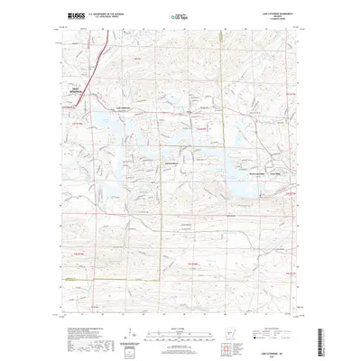
2020 Map of Lake Catherine
USGS Topo · Published 2020About this map
Lake Catherine anchors this portion of the Ouachita River valley, serving as a focal point for several residential developments that define the local geography. Established communities like Diamondhead, Shorewood Hills, and Jones Mills are situated along the winding shoreline, reflecting the area's growth as a residential and recreational corridor between the larger hub of Hot Springs and the surrounding rural landscapes. The terrain is marked by significant elevations including Bald Mtn and Narrow Mtn, while the historical footprint of the region is preserved at sites like Twin Cem and Price Cem.
Find a feature on this map
172 named features on this map. Tap any name to fly to it.
Don’t see what you’re looking for? This feature index may not catch every label — zoom into the map to look around manually.
Map Details
Editions of this 2020 Lake Catherine Map
This is the sole edition of this map. No revisions or reprints were ever made.
Other maps of this area

1890 · Benton
USGS Topo · 1:125,000

1890 · Hot Springs
USGS Topo · 1:125,000

1894 · Hot Springs
USGS Topo · 1:125,000

1894 · Benton
USGS Topo · 1:125,000

1948 · Malvern
USGS Topo · 1:62,500

1949 · Malvern
USGS Topo · 1:62,500

1955 · Little Rock
USGS Topo · 1:250,000

1956 · Little Rock
USGS Topo · 1:250,000

1960 · Little Rock
USGS Topo · 1:250,000

1964 · Little Rock
USGS Topo · 1:250,000