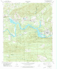
1978 Map of Lake Catherine
USGS Topo · Published 1979About this map
The Ouachita River corridor dominates this late-1970s landscape, defined by the industrial and recreational infrastructure surrounding Lake Catherine. The impoundment is anchored by the Remmel Dam, while developments like Diamondhead and Shorewood Hills reflect the mid-century growth of residential and leisure communities along the shoreline. Industrial footprints are evident at the eastern edge near Jones Mills and the extensive Mines and Quarries located north of the water, illustrating the area's dual role as a resource extraction zone and a public retreat.
Find a feature on this map
56 named features on this map. Tap any name to fly to it.
Don’t see what you’re looking for? This feature index may not catch every label — zoom into the map to look around manually.
Map Details
Editions of this 1978 Lake Catherine Map
2 editions found
Other maps of this area

1890 · Benton
USGS Topo · 1:125,000

1890 · Hot Springs
USGS Topo · 1:125,000

1894 · Hot Springs
USGS Topo · 1:125,000

1894 · Benton
USGS Topo · 1:125,000

1948 · Malvern
USGS Topo · 1:62,500

1949 · Malvern
USGS Topo · 1:62,500

1955 · Little Rock
USGS Topo · 1:250,000

1956 · Little Rock
USGS Topo · 1:250,000

1960 · Little Rock
USGS Topo · 1:250,000

1964 · Little Rock
USGS Topo · 1:250,000