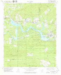
1978 Map of Lake Catherine
USGS Topo · Published 1979About this map
Lake Catherine serves as the central focal point of this late-1970s landscape, where the waters of the Ouachita River are harnessed at the Remmel Dam. This area, split between Garland and Hot Spring counties, shows a transition from the urban fringes of Hot Springs to the recreational and industrial zones of central Arkansas. The Chicago Rock Island and Pacific railroad tracks trace the northern shoreline, connecting industrial sites like Jones Mills and the mines near Bald Mountain. Residential developments such as Diamondhead and Shorewood Hills appear alongside institutional landmarks like Camp Couchdale and Camp Tanako. Rural heritage is preserved in the location of Sulphur Springs Ch, Irwin Cem, and Lakeside Sch, while Lake Catherine State Park occupies the peninsula formed by the winding river and Narrow Mountain.
Find a feature on this map
62 named features on this map. Tap any name to fly to it.
Don’t see what you’re looking for? This feature index may not catch every label — zoom into the map to look around manually.
Map Details
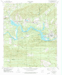
Editions of this 1978 Lake Catherine Map
2 editions found
Other maps of this area

1890 · Benton
USGS Topo · 1:125,000

1890 · Hot Springs
USGS Topo · 1:125,000

1894 · Hot Springs
USGS Topo · 1:125,000

1894 · Benton
USGS Topo · 1:125,000

1948 · Malvern
USGS Topo · 1:62,500

1949 · Malvern
USGS Topo · 1:62,500

1955 · Little Rock
USGS Topo · 1:250,000

1956 · Little Rock
USGS Topo · 1:250,000

1960 · Little Rock
USGS Topo · 1:250,000

1964 · Little Rock
USGS Topo · 1:250,000