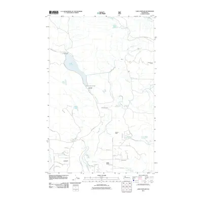
2011 Map of Lake Chaplain
USGS Topo · Published 2011About this map
Lake Chaplain dominates this Snohomish County landscape, serving as a critical reservoir for the region as evidenced by the Chaplain Lake North Dam, Chaplain Lake South Dam, and the Everett Water Work Intake. The Sultan River winds through the center of the sheet, carving a dramatic Horseshoe Bend before heading south toward the settlement of North Sultan. This area represents a vital intersection of municipal infrastructure and natural resource management, where the rugged topography of Haywire Ridge and Blue Mountain Lookout overlooks a network of timber and access roads like Monroe Camp Rd and Diversion Dam Rd. To the south, the transition from forest to local development is marked by the Blue Boy West Golf Course and a grid of rural residential streets. The map also records several smaller upland water bodies including Echo Lake, Winters Lake, and Kellog Lake, alongside various creeks that feed the larger river system.
Find a feature on this map
61 named features on this map. Tap any name to fly to it.
Don’t see what you’re looking for? This feature index may not catch every label — zoom into the map to look around manually.
Map Details
Editions of this 2011 Lake Chaplain Map
This is the sole edition of this map. No revisions or reprints were ever made.
Other maps of this area

1899 · Stillaguamish
USGS Topo · 1:125,000

1901 · Stilaguamish
USGS Topo · 1:125,000

1921 · Sultan
USGS Topo · 1:125,000

1923 · Sultan
USGS Topo · 1:125,000

1953 · Sultan
USGS Topo · 1:24,000

1953 · Monroe
USGS Topo · 1:24,000

1955 · Concrete
USGS Topo · 1:250,000

1956 · Monroe
USGS Topo · 1:62,500

1956 · Granite Falls
USGS Topo · 1:62,500

1957 · Silverton
USGS Topo · 1:62,500