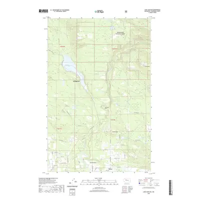
2020 Map of Lake Chaplain
USGS Topo · Published 2020About this map
Lake Chaplain dominates the western portion of this landscape, serving as a primary reservoir for the city of Everett and illustrating the critical connection between the mountain watersheds and urban infrastructure. The Sultan River carves a deep path through the eastern terrain, winding past Horseshoe Bend as it flows south toward the settlements of Sultan and North Sultan. Much of the northern and eastern territory lies within the Snoqualmie National Forest, where steep elevations like Sultan Ridge and Haywire Ridge define the drainage patterns for numerous smaller bodies of water, including Lake Bronson and Japanese Lake. A complex network of service and logging roads, such as Lake Chaplain Rd and Diversion Dam Rd, provides access to these managed forest lands and water resources.
Find a feature on this map
56 named features on this map. Tap any name to fly to it.
Don’t see what you’re looking for? This feature index may not catch every label — zoom into the map to look around manually.
Map Details
Editions of this 2020 Lake Chaplain Map
This is the sole edition of this map. No revisions or reprints were ever made.
Other maps of this area

1899 · Stillaguamish
USGS Topo · 1:125,000

1901 · Stilaguamish
USGS Topo · 1:125,000

1921 · Sultan
USGS Topo · 1:125,000

1923 · Sultan
USGS Topo · 1:125,000

1953 · Sultan
USGS Topo · 1:24,000

1953 · Monroe
USGS Topo · 1:24,000

1955 · Concrete
USGS Topo · 1:250,000

1956 · Monroe
USGS Topo · 1:62,500

1956 · Granite Falls
USGS Topo · 1:62,500

1957 · Silverton
USGS Topo · 1:62,500