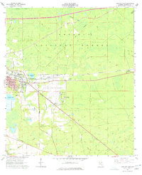
1962 Map of Lake City East
USGS Topo · Published 1977About this map
Lake City is captured here as a growing North Florida hub during the early 1960s, defined by the intersection of the Seaboard Air Line and Southern railroads. The eastern edge of the city transitions into the industrial and institutional landscapes of the Lake City Municipal Airport and the campus of Lake City Jr College. Near Watertown Lake, the settlement of Watertown remains a distinct community cluster, while the northern half of the map is dominated by the dense pine stands of the Osceola National Forest.
Find a feature on this map
40 named features on this map. Tap any name to fly to it.
Don’t see what you’re looking for? This feature index may not catch every label — zoom into the map to look around manually.
Map Details
Editions of this 1962 Lake City East Map
3 editions found
Other maps of this area

1954 · Valdosta
USGS Topo · 1:250,000

1958 · Valdosta
USGS Topo · 1:250,000

1959 · Valdosta
USGS Topo · 1:250,000

1961 · Deep Creek
USGS Topo · 1:24,000

1961 · White Springs East
USGS Topo · 1:24,000

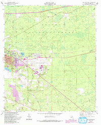
1962 · Lake City East
USGS Topo · 1:24,000

1963 · Olustee
USGS Topo · 1:24,000

1963 · Ellisville
USGS Topo · 1:24,000

1963 · Columbia
USGS Topo · 1:24,000

1963 · Lake City West
USGS Topo · 1:24,000