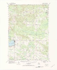
1956 Map of Lake City
USGS Topo · Published 1984About this map
Lake City serves as the focal point of this mid-century survey, situated on the northeastern shore of Lake Missaukee. The landscape reflects a mix of organized timber management and resource extraction, with vast tracts of the Houghton Lake State Forest punctuated by the Butterfield Oil Field in the southeast. Social and community structures are well-documented through small crossroads settlements like Morey, Stittsville, and Keelans Corner.
Find a feature on this map
56 named features on this map. Tap any name to fly to it.
Don’t see what you’re looking for? This feature index may not catch every label — zoom into the map to look around manually.
Map Details
Editions of this 1956 Lake City Map
3 editions found
Other maps of this area

1949 · Fletcher
USGS Topo · 1:62,500

1950 · Fletcher
USGS Topo · 1:24,000

1954 · Traverse City
USGS Topo · 1:250,000

1956 · Kalkaska
USGS Topo · 1:62,500

1956 · Fife Lake
USGS Topo · 1:62,500

1956 · Houghton Lake
USGS Topo · 1:62,500

1956 · Cadillac North
USGS Topo · 1:62,500

1956 · Lake City
USGS Topo · 1:62,500

1957 · Harrison
USGS Topo · 1:62,500

1957 · Cadillac South
USGS Topo · 1:62,500