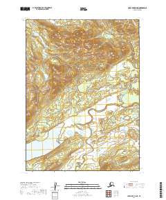
2019 Map of Lake Clark A-6 NE
USGS Topo · Published 2019About this map
Chulitna River and Koksetna River dominate this segment of the Lake and Peninsula Borough, carving through a landscape of extensive wetlands and glacial water bodies. The serpentine path of the Chulitna River illustrates the slow-moving hydrologic patterns of the region, where the water table sits nearly flush with the surrounding terrain. To the west, Joe Nort Lake and the northern reach of Long Lake provide distinct landmarks in an area primarily defined by township boundaries like t2n r33w and t1n r33w. This 2019 survey by the U.S. Geological Survey documents the natural drainage and elevation of the territory before any significant infrastructure or road development reached this part of the Alaska wilderness.
Find a feature on this map
9 named features on this map. Tap any name to fly to it.
Don’t see what you’re looking for? This feature index may not catch every label — zoom into the map to look around manually.
Map Details
Editions of this 2019 Lake Clark A-6 NE Map
This is the sole edition of this map. No revisions or reprints were ever made.
Other maps of this area

1946 · Lake Clark
USGS Topo · 1:250,000

1951 · Lake Clark
USGS Topo · 1:250,000

1954 · Lake Clark A-6
USGS Topo · 1:63,360

1954 · Lake Clark B-5
USGS Topo · 1:63,360

1954 · Lake Clark A-5
USGS Topo · 1:63,360

1954 · Lake Clark B-6
USGS Topo · 1:63,360

1958 · Lake Clark
USGS Topo · 1:250,000
2018 · Lake Clark A-5 SW
USGS Topo · 1:25,000
2018 · Lake Clark B-5 SW
USGS Topo · 1:25,000
2018 · Lake Clark A-5 NW
USGS Topo · 1:25,000