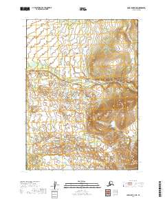
2019 Map of Lake Clark B-7 NE
USGS Topo · Published 2019About this map
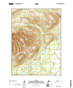
Braided river channels and complex glacial hydrology define this remote Alaskan landscape within the Chilchitna River basin. As mapped in 2019, the terrain showcases a dense network of wetlands and small kettle ponds characteristic of the Lake and Peninsula Borough. The presence of the Nikadavna Cr in the southwest and Dummy Cr to the north illustrates the intricate drainage patterns that feed into the region's larger river systems. This USGS data provides a precise look at the shifting surface water and topographic relief of the Lake Clark region, where elevation rises sharply into unnamed peaks in the eastern portions of the quadrangle. The lack of roads or established settlements emphasizes the wilderness character of the area, making this a critical reference for understanding the natural geography and water flow through this portion of the interior.
Find a feature on this map
9 named features on this map. Tap any name to fly to it.
Don’t see what you’re looking for? This feature index may not catch every label — zoom into the map to look around manually.
Map Details
Editions of this 2019 Lake Clark B-7 NE Map
This is the sole edition of this map. No revisions or reprints were ever made.
Other maps of this area

1946 · Lake Clark
USGS Topo · 1:250,000

1951 · Lake Clark
USGS Topo · 1:250,000

1954 · Lake Clark C-7
USGS Topo · 1:63,360

1954 · Lake Clark C-6
USGS Topo · 1:63,360

1954 · Lake Clark B-6
USGS Topo · 1:63,360
1954 · Lake Clark B-7
USGS Topo · 1:63,360

1958 · Lake Clark
USGS Topo · 1:250,000
2019 · Lake Clark C-7 SE
USGS Topo · 1:25,000
2019 · Lake Clark B-7 SE
USGS Topo · 1:25,000
2019 · Lake Clark C-7 SW
USGS Topo · 1:25,000