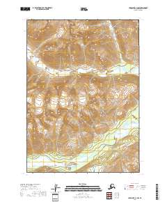
2018 Map of Lake Clark C-1 NW
USGS Topo · Published 2018About this map
Lake Clark National Park encompasses the entirety of this Alaskan landscape, where the high country of the Kenai Peninsula Borough is defined by glacial drainages and extreme relief. The Tlikakila River winds through the southern valley floor, joined by the North Fork Tlikakila River which cuts through the central peaks. This environment is characterized by sharp transitions from valley bottoms to the steep walls of the surrounding mountain ranges, mapped here with 80-foot contour intervals to capture the dramatic elevation changes. A significant transit point for those navigating the interior is Moose Pasture Pass, a natural corridor located in the southern portion of the quadrangle. The map serves as a primary record of this wilderness before further glacial retreat or environmental shifts altered these specific river courses and drainage patterns.
Find a feature on this map
10 named features on this map. Tap any name to fly to it.
Don’t see what you’re looking for? This feature index may not catch every label — zoom into the map to look around manually.
Map Details
Editions of this 2018 Lake Clark C-1 NW Map
This is the sole edition of this map. No revisions or reprints were ever made.
Other maps of this area

1946 · Lake Clark
USGS Topo · 1:250,000

1951 · Lake Clark
USGS Topo · 1:250,000
1958 · Lake Clark D-2
USGS Topo · 1:63,360

1958 · Lake Clark C-2
USGS Topo · 1:63,360
1958 · Lake Clark D-1
USGS Topo · 1:63,360
1958 · Lake Clark C-1
USGS Topo · 1:63,360

1958 · Lake Clark
USGS Topo · 1:250,000
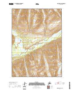
2018 · Lake Clark C-1 NE
USGS Topo · 1:25,000
2018 · Lake Clark D-1 SW
USGS Topo · 1:25,000
2018 · Lake Clark D-2 SE
USGS Topo · 1:25,000