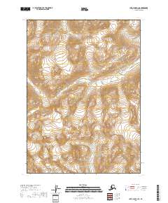
2018 Map of Lake Clark C-1 SE
USGS Topo · Published 2018About this map
The Aleutian Range dominates this portion of Lake Clark National Park, where high-elevation ice and steep drainage patterns define the landscape of the Kenai Peninsula. The glacial water system is anchored by the Drift River flowing through the northeast and the Chokotonk River cutting across the western sections. In the southern reaches of the quadrangle, the Lake Fork Crescent River emerges from the high peaks. This 2018 survey provides an exact look at the natural boundaries and hydrologic features before they were further altered by modern environmental shifts, serving as a vital reference for understanding the topographic character of this protected wilderness.
Find a feature on this map
9 named features on this map. Tap any name to fly to it.
Don’t see what you’re looking for? This feature index may not catch every label — zoom into the map to look around manually.
Map Details
Editions of this 2018 Lake Clark C-1 SE Map
This is the sole edition of this map. No revisions or reprints were ever made.
Other maps of this area

1944 · Kenai
USGS Topo · 1:250,000

1946 · Lake Clark
USGS Topo · 1:250,000

1950 · Kenai
USGS Topo · 1:250,000

1951 · Lake Clark
USGS Topo · 1:250,000

1958 · Lake Clark B-1
USGS Topo · 1:63,360

1958 · Kenai B-8
USGS Topo · 1:63,360

1958 · Kenai C-8
USGS Topo · 1:63,360
1958 · Lake Clark C-1
USGS Topo · 1:63,360

1958 · Lake Clark
USGS Topo · 1:250,000

1958 · Kenai
USGS Topo · 1:250,000