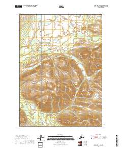
2018 Map of Lake Clark C-4 SW
USGS Topo · Published 2018About this map
Lake Clark National Preserve dominates this wild Alaskan landscape, which remains largely untouched and roadless in the twenty-first century. The terrain is defined by the high, alpine headwaters of two significant waterways: the north-flowing Chilikadrotna River and the southward-draining Little Mulchatna River. This 2018 survey reveals a topography of sharp elevation changes and high mountain basins, typical of the Lake and Peninsula Borough. The absence of human-named landmarks or settlements highlights the wilderness character of the region, where the primary features are the natural drainage patterns and the federally protected lands of the preserve.
Find a feature on this map
7 named features on this map. Tap any name to fly to it.
Don’t see what you’re looking for? This feature index may not catch every label — zoom into the map to look around manually.
Map Details
Editions of this 2018 Lake Clark C-4 SW Map
This is the sole edition of this map. No revisions or reprints were ever made.
Other maps of this area

1946 · Lake Clark
USGS Topo · 1:250,000

1951 · Lake Clark
USGS Topo · 1:250,000

1954 · Lake Clark C-4
USGS Topo · 1:63,360

1954 · Lake Clark B-5
USGS Topo · 1:63,360

1954 · Lake Clark C-5
USGS Topo · 1:63,360

1954 · Lake Clark B-4
USGS Topo · 1:63,360

1958 · Lake Clark
USGS Topo · 1:250,000
2018 · Lake Clark C-4 NE
USGS Topo · 1:25,000
2018 · Lake Clark C-4 NW
USGS Topo · 1:25,000
2018 · Lake Clark C-4 SE
USGS Topo · 1:25,000