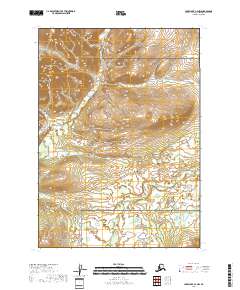
2018 Map of Lake Clark C-4 NW
USGS Topo · Published 2018About this map
Lake Clark National Preserve dominates this wild Alaskan landscape, where the shifting elevations of the Bonanza Hills give way to a complex network of wetlands and river systems. The topographic detail highlights the winding course of the Chilikadrotna River as it flows through the southern portion of the quadrangle, fed by tributaries like Ptarmigan Cr. This 2018 survey reveals a terrain defined by high ridges and low-lying marshes, illustrating the preserved natural state of the Lake and Peninsula Borough. The absence of roads or established settlements underscores the area's role as a protected wilderness, where hydrological patterns and mountain contours are the primary markers of the land.
Find a feature on this map
10 named features on this map. Tap any name to fly to it.
Don’t see what you’re looking for? This feature index may not catch every label — zoom into the map to look around manually.
Map Details
Editions of this 2018 Lake Clark C-4 NW Map
This is the sole edition of this map. No revisions or reprints were ever made.
Other maps of this area

1946 · Lake Clark
USGS Topo · 1:250,000

1951 · Lake Clark
USGS Topo · 1:250,000

1954 · Lake Clark C-4
USGS Topo · 1:63,360

1954 · Lake Clark D-5
USGS Topo · 1:63,360

1954 · Lake Clark C-5
USGS Topo · 1:63,360

1954 · Lake Clark D-4
USGS Topo · 1:63,360

1958 · Lake Clark
USGS Topo · 1:250,000
2018 · Lake Clark C-4 NE
USGS Topo · 1:25,000
2018 · Lake Clark C-4 SE
USGS Topo · 1:25,000
2018 · Lake Clark C-4 SW
USGS Topo · 1:25,000