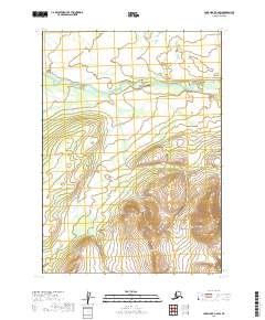
2019 Map of Lake Clark C-6 SW
USGS Topo · Published 2019About this map
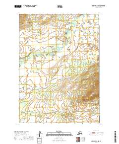
The Chilikadrotna River cuts a wide, braided path across the northern reaches of this Alaskan interior landscape, illustrating the dynamic glacial-fed hydrology of the Lake Clark region. This 2019 survey documents the high-altitude terrain south of the river, where drainage patterns are defined by the seasonal flow of Dummy Cr. The map is primarily characterized by its lack of human infrastructure, focusing instead on the complex relief and township boundaries like t6n r33w and t5n r34w. It preserves the natural state of this watershed before significant development, showing the subtle interplay of alluvial flats and steep alpine contours that define this remote corner of the Lake and Peninsula Borough.
Find a feature on this map
6 named features on this map. Tap any name to fly to it.
Don’t see what you’re looking for? This feature index may not catch every label — zoom into the map to look around manually.
Map Details
Editions of this 2019 Lake Clark C-6 SW Map
This is the sole edition of this map. No revisions or reprints were ever made.
Other maps of this area

1946 · Lake Clark
USGS Topo · 1:250,000

1951 · Lake Clark
USGS Topo · 1:250,000

1954 · Lake Clark C-7
USGS Topo · 1:63,360

1954 · Lake Clark C-6
USGS Topo · 1:63,360

1954 · Lake Clark B-6
USGS Topo · 1:63,360
1954 · Lake Clark B-7
USGS Topo · 1:63,360

1958 · Lake Clark
USGS Topo · 1:250,000
2019 · Lake Clark C-7 SE
USGS Topo · 1:25,000
2019 · Lake Clark C-7 NE
USGS Topo · 1:25,000
2019 · Lake Clark C-6 NW
USGS Topo · 1:25,000