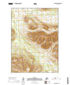
2019 Map of Lake Clark D-7 SW
USGS Topo · Published 2019About this map
The S Fork Hoholitna River meanders through the western half of this interior Alaskan landscape, defining the topography between high ridges and drainage basins. This area, located within the Lake and Peninsula Borough, remains largely undeveloped, with no roads or permanent structures indicated in this late-2010s survey. The hydrography is dominated by the Hoholitna system and its smaller tributaries, including Gnat Cr in the north and McKinley Cr in the southeast. The terrain is characterized by significant elevation changes, with ridges rising between the river valleys, documented by the U.S. Geological Survey using modern data sources including SPOT imagery from 2010. The lack of human infrastructure highlights the untouched nature of this subarctic wilderness near the turn of the 21st century.
Find a feature on this map
7 named features on this map. Tap any name to fly to it.
Don’t see what you’re looking for? This feature index may not catch every label — zoom into the map to look around manually.
Map Details
Editions of this 2019 Lake Clark D-7 SW Map
This is the sole edition of this map. No revisions or reprints were ever made.
Other maps of this area

1946 · Lake Clark
USGS Topo · 1:250,000

1951 · Lake Clark
USGS Topo · 1:250,000

1954 · Lake Clark C-7
USGS Topo · 1:63,360

1954 · Lake Clark C-8
USGS Topo · 1:63,360

1954 · Lake Clark D-8
USGS Topo · 1:63,360

1954 · Lake Clark D-7
USGS Topo · 1:63,360

1958 · Lake Clark
USGS Topo · 1:250,000
2019 · Lake Clark D-7 NE
USGS Topo · 1:25,000
2019 · Lake Clark D-7 NW
USGS Topo · 1:25,000
2019 · Lake Clark C-7 NE
USGS Topo · 1:25,000