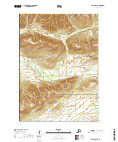
2019 Map of Lake Clark D-7 NE
USGS Topo · Published 2019About this map
The Hoholitna River winds through this interior landscape, marking a path across a region where the Bethel Census Area meets the Lake and Peninsula Borough. This topographical survey illustrates a remote portion of Alaska defined by severe elevation changes and complex drainage patterns. In the southern reach of the map, Gnat Cr emerges from the high ground, contributing to the broader watershed. The map provides a detailed view of the terrain before major modern infrastructure reaches this wilderness, showing the intricate contour lines that define the ridges and valleys of the northern Lake Clark vicinity. This specific area serves as a critical point of study for understanding the natural boundaries and geographic divisions between these two large administrative districts.
Find a feature on this map
9 named features on this map. Tap any name to fly to it.
Don’t see what you’re looking for? This feature index may not catch every label — zoom into the map to look around manually.
Map Details
Editions of this 2019 Lake Clark D-7 NE Map
This is the sole edition of this map. No revisions or reprints were ever made.
Other maps of this area

1946 · Lake Clark
USGS Topo · 1:250,000

1951 · Lake Clark
USGS Topo · 1:250,000

1951 · Lime Hills
USGS Topo · 1:250,000

1954 · Lake Clark D-7
USGS Topo · 1:63,360

1954 · Lime Hills A-7
USGS Topo · 1:63,360

1954 · Lime Hills A-6
USGS Topo · 1:63,360
1954 · Lake Clark D-6
USGS Topo · 1:63,360

1958 · Lake Clark
USGS Topo · 1:250,000

1958 · Lime Hills
USGS Topo · 1:250,000
2019 · Lake Clark D-6 NW
USGS Topo · 1:25,000