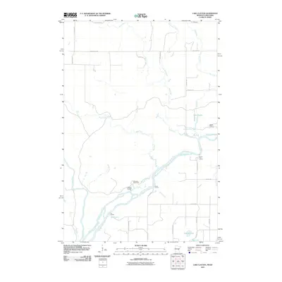
2010 Map of Lake Clayton
USGS Topo · Published 2010About this map
The Saint Croix River forms a complex hydrological borderland where it meets the Kettle River and several smaller tributaries like Bear Paw Creek and Ekdall Brook. This 2010 survey details a landscape defined by river access and recreational or historical landings, such as Norway Point Landing and Fox Landing. The presence of established camps like Head of the Rapids Camp near the Head of the Rapids Landing suggests a region long utilized for its riverine navigation and proximity to the water.
Find a feature on this map
38 named features on this map. Tap any name to fly to it.
Don’t see what you’re looking for? This feature index may not catch every label — zoom into the map to look around manually.
Map Details
Editions of this 2010 Lake Clayton Map
This is the sole edition of this map. No revisions or reprints were ever made.
Other maps of this area

1950 · Grantsburg
USGS Topo · 1:48,000

1953 · Duluth
USGS Topo · 1:250,000

1953 · Stillwater
USGS Topo · 1:250,000

1955 · Stillwater
USGS Topo · 1:250,000

1958 · Stillwater
USGS Topo · 1:250,000

1958 · Duluth
USGS Topo · 1:250,000

1961 · Sandstone
USGS Topo · 1:62,500

1961 · Pine City
USGS Topo · 1:62,500

1962 · Cloverdale
USGS Topo · 1:62,500

1962 · Grantsburg
USGS Topo · 1:62,500