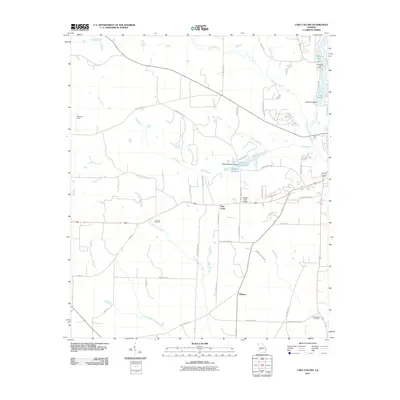
2011 Map of Lake Collins
USGS Topo · Published 2011About this map
Muckalee Creek and its many tributaries, including Wolf Creek, dominate this rural Sumter County landscape. The area is defined by its water management and agricultural heritage, featuring multiple impoundments such as Lake Collins, Statham Lake, and McMath Millpond. These water bodies are often accompanied by early 21st-century infrastructure like the Lake Collins Dam and Statham Lake Dam. Small settlements and naming conventions reflect a deep-rooted local history, with New Point and Thalean serving as geographic anchors amidst a network of family-named roads like Youngs Mill Rd and McMath Hill Rd.
Find a feature on this map
54 named features on this map. Tap any name to fly to it.
Don’t see what you’re looking for? This feature index may not catch every label — zoom into the map to look around manually.
Map Details
Editions of this 2011 Lake Collins Map
This is the sole edition of this map. No revisions or reprints were ever made.
Other maps of this area

1953 · Dothan
USGS Topo · 1:250,000

1954 · Dothan
USGS Topo · 1:250,000

1955 · Dothan
USGS Topo · 1:250,000

1955 · Phenix City
USGS Topo · 1:250,000

1956 · Leslie
USGS Topo · 1:62,500

1957 · Phenix City
USGS Topo · 1:250,000

1958 · Phenix City
USGS Topo · 1:250,000

1972 · Ellaville South
USGS Topo · 1:24,000
1972 · Andersonville
USGS Topo · 1:24,000
1973 · Americus
USGS Topo · 1:24,000