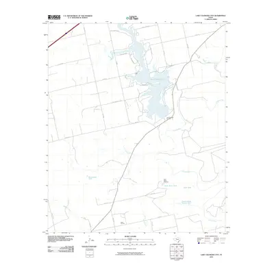
2010 Map of Lake Colorado City
USGS Topo · Published 2010About this map
Lake Colorado City dominates this West Texas landscape, formed by the Lake Colorado City Dam along the Colorado River. The surrounding terrain is defined by a network of ranch roads and water management features essential to this arid region. Significant local water sources include River Ranch Tank, Rattlesnake Tank, and the uniquely named Five Hundred Pasture Tank. These tanks and dams indicate a long history of cattle ranching and land use tailored to the environment.
Find a feature on this map
38 named features on this map. Tap any name to fly to it.
Don’t see what you’re looking for? This feature index may not catch every label — zoom into the map to look around manually.
Map Details
Editions of this 2010 Lake Colorado City Map
This is the sole edition of this map. No revisions or reprints were ever made.
Other maps of this area

1950 · Cedar Bend
USGS Topo · 1:24,000

1950 · Lake Colorado City
USGS Topo · 1:24,000

1950 · Colorado City SE
USGS Topo · 1:24,000

1952 · Cuthbert
USGS Topo · 1:24,000

1952 · Westbrook
USGS Topo · 1:24,000

1952 · Colorado City
USGS Topo · 1:24,000

1954 · Big Spring
USGS Topo · 1:250,000

1958 · Big Spring
USGS Topo · 1:250,000

1959 · Pecan Crossing
USGS Topo · 1:24,000

1959 · Spade Ranch
USGS Topo · 1:24,000