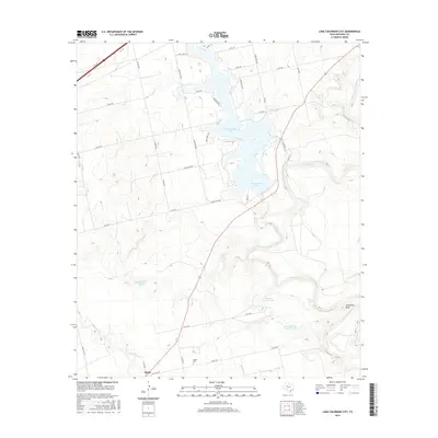
2016 Map of Lake Colorado City
USGS Topo · Published 2016About this map
Lake Colorado City dominates the northern half of this West Texas landscape, serving as a primary water source and geographic anchor in Mitchell County. The reservoir is fed by and adjacent to the Colorado River, which winds through the eastern portion of the map, creating the distinctive Horseshoe Bend as it flows southward. The topography is defined by the drainages of Wildhorse Creek, Camp Creek, and Morgan Creek, which cut through the ranchland.
Find a feature on this map
46 named features on this map. Tap any name to fly to it.
Don’t see what you’re looking for? This feature index may not catch every label — zoom into the map to look around manually.
Map Details
Editions of this 2016 Lake Colorado City Map
This is the sole edition of this map. No revisions or reprints were ever made.
Other maps of this area

1950 · Cedar Bend
USGS Topo · 1:24,000

1950 · Lake Colorado City
USGS Topo · 1:24,000

1950 · Colorado City SE
USGS Topo · 1:24,000

1952 · Cuthbert
USGS Topo · 1:24,000

1952 · Westbrook
USGS Topo · 1:24,000

1952 · Colorado City
USGS Topo · 1:24,000

1954 · Big Spring
USGS Topo · 1:250,000

1958 · Big Spring
USGS Topo · 1:250,000

1959 · Pecan Crossing
USGS Topo · 1:24,000

1959 · Spade Ranch
USGS Topo · 1:24,000