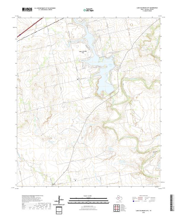
2022 Map of Lake Colorado City
USGS Topo · Published 2022About this map
Lake Colorado City dominates the northern half of this Mitchell County landscape, where the reservoir's irregular shoreline is defined by several recreation paths like the Cactus Cut Trl and Roadrunner Loop Trl. To the south, the Colorado River meanders toward the distinctive Horseshoe Bend, flanked by a network of drainage creeks including Camp Cr and Morgan Cr. The area maintains a rural ranching character, evident in the numerous water catchments such as Rattlesnake Tank and Five Hundred Pasture Tank that dot the terrain.
Find a feature on this map
50 named features on this map. Tap any name to fly to it.
Don’t see what you’re looking for? This feature index may not catch every label — zoom into the map to look around manually.
Map Details
Editions of this 2022 Lake Colorado City Map
This is the sole edition of this map. No revisions or reprints were ever made.
Other maps of this area

1950 · Cedar Bend
USGS Topo · 1:24,000

1950 · Lake Colorado City
USGS Topo · 1:24,000

1950 · Colorado City SE
USGS Topo · 1:24,000

1952 · Cuthbert
USGS Topo · 1:24,000

1952 · Westbrook
USGS Topo · 1:24,000

1952 · Colorado City
USGS Topo · 1:24,000

1954 · Big Spring
USGS Topo · 1:250,000

1958 · Big Spring
USGS Topo · 1:250,000

1959 · Pecan Crossing
USGS Topo · 1:24,000

1959 · Spade Ranch
USGS Topo · 1:24,000