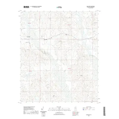
2020 Map of Lake Como
USGS Topo · Published 2020About this map
Bay Springs and the surrounding piney woods of Jasper County are defined by a network of rural routes and waterway-fed drainages. This landscape features small, established communities like Lake Como and Acme, where the presence of numerous burial grounds—including Lake Como Cem, Enanon Cem, and Enon Cem—provides significant points of reference for genealogists tracking local families. The terrain is deeply etched by Tallahoma Cr, Piney Cr, and Nuakiuppa Cr, which dictated the early settlement patterns and road placements, such as N Pine Ave and various county roads. Near the western edge, Thigpen Field stands out as a specialized landmark amidst the timberlands, while the community of Vernon anchors the southeastern portion of the quadrangle. The map details the rural character of central Mississippi, showing the persistent footprint of small hamlets and the essential role of creek systems in defining local geography.
Find a feature on this map
38 named features on this map. Tap any name to fly to it.
Don’t see what you’re looking for? This feature index may not catch every label — zoom into the map to look around manually.
Map Details
Editions of this 2020 Lake Como Map
This is the sole edition of this map. No revisions or reprints were ever made.
Other maps of this area

1953 · Hattiesburg
USGS Topo · 1:250,000

1953 · Meridian
USGS Topo · 1:250,000

1957 · Meridian
USGS Topo · 1:250,000

1958 · Hattiesburg
USGS Topo · 1:250,000

1963 · Waldrup
USGS Topo · 1:24,000

1964 · Moss
USGS Topo · 1:24,000

1964 · Sandersville
USGS Topo · 1:24,000

1964 · Lake Como
USGS Topo · 1:24,000

1965 · Meridian
USGS Topo · 1:250,000

1968 · Louin
USGS Topo · 1:24,000