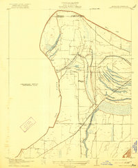
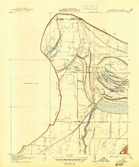
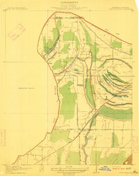
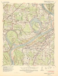
1912 Map of Lake Cormorant
USGS Topo · Published 1921About this map
Lake Cormorant and the surrounding alluvial lowlands of DeSoto County dominate this 1908 survey, capturing the delta landscape before modern flood control reshaped the region. This area, surveyed for the Tallahatchie Drainage Commission, illustrates a complex network of wetlands and oxbow remnants including Fish Lake and Horn Lake. The presence of Morning Star Church and small settlements like Glover and Blue Goose provides a clear view of early 20th-century social hubs in an economy tied closely to the river and rail.
Find a feature on this map
16 named features on this map. Tap any name to fly to it.
Don’t see what you’re looking for? This feature index may not catch every label — zoom into the map to look around manually.
Map Details
Editions of this 1912 Lake Cormorant Map
3 editions found
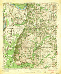
Other maps of this area

1908 · Lake Cormorant
USGS Topo · 1:24,000
1912 · Lake Cormorant
USGS Topo · 1:31,680

1916 · Memphis
USGS Topo · 1:62,500

1925 · Memphis
USGS Topo · 1:48,000

1927 · Memphis
USGS Topo · 1:62,500

1931 · Horseshoe Lake
USGS Topo · 1:62,500

1932 · Horn Lake
USGS Topo · 1:48,000
1935 · Horn Lake
USGS Topo · 1:62,500
1939 · Horseshoe Lake
USGS Topo · 1:62,500
1939 · Edmondson
USGS Topo · 1:62,500