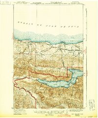
1922 Map of Lake Crescent
USGS Topo · Published 1943About this map
Lake Crescent dominates this 1918 survey of Clallam County, showing the region as the boundaries of the Olympic National Forest and the recently established Olympic National Park were taking shape. The map illustrates a transitional economy where early recreation and resource extraction coexist, with a Logging RR and the St Paul and Milwaukee and Pacific line servicing the northern timberlands near the Strait of Juan de Fuca.
Find a feature on this map
50 named features on this map. Tap any name to fly to it.
Don’t see what you’re looking for? This feature index may not catch every label — zoom into the map to look around manually.
Map Details
Editions of this 1922 Lake Crescent Map
3 editions found
Other maps of this area

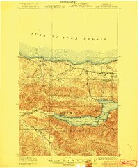
1918 · Lake Crescent
USGS Topo · 1:62,500

1919 · Port Crescent
USGS Topo · 1:62,500

1922 · Pysht
USGS Topo · 1:62,500

1922 · Lake Crescent
USGS Topo · 1:62,500

1935 · Mount Olympus
USGS Topo · 1:62,500

1939 · Mount Tom
USGS Topo · 1:62,500

1942 · Pysht
USGS Topo · 1:62,500

1942 · Mount Olympus
USGS Topo · 1:62,500

1943 · Spruce Mountain
USGS Topo · 1:62,500

1943 · Copalis Beach
USGS Topo · 1:250,000