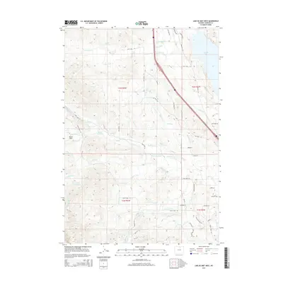
2015 Map of Lake De Smet West
USGS Topo · Published 2015About this map
Lake De Smet anchors the eastern edge of this Johnson County landscape, where a complex network of man-made waterways illustrates the intensive water management of the Wyoming foothills. The terrain transitions from the elevations of Mowry Basin toward the plains, marked by a sophisticated system of irrigation features such as the Pride of the Valley Ditch, Yarwood Ditch, and Ruby Ditch. These ditches, alongside the Lake De Smet Canal, trace the history of land use and agricultural development in the region.
Find a feature on this map
70 named features on this map. Tap any name to fly to it.
Don’t see what you’re looking for? This feature index may not catch every label — zoom into the map to look around manually.
Map Details
Editions of this 2015 Lake De Smet West Map
This is the sole edition of this map. No revisions or reprints were ever made.
Other maps of this area

1900 · Fort McKinney
USGS Topo · 1:125,000

1903 · Fort McKinney
USGS Topo · 1:125,000

1909 · Sheridan
USGS Topo · 1:125,000

1911 · Sheridan
USGS Topo · 1:125,000

1955 · Sheridan
USGS Topo · 1:250,000

1958 · Sheridan
USGS Topo · 1:250,000

1962 · Sheridan
USGS Topo · 1:250,000

1967 · Lake De Smet West
USGS Topo · 1:24,000
1967 · Hunter Mesa
USGS Topo · 1:24,000
1967 · Stone Mountain
USGS Topo · 1:24,000