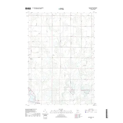
2018 Map of Lake Dexter
USGS Topo · Published 2018About this map
Pittsville and Dexterville anchor this Wood County landscape, where the southern reaches are dominated by the waters of Lake Dexter. The region is defined by a dense network of watercourses, including the winding path of Hemlock Creek and its tributary, Little Hemlock Cr, alongside Cat Cr and Dawes Cr. This drainage pattern supports an extensive system of wetlands that permeates the rural sections between the primary settlements. To the north, the terrain transitions into a more structured grid of local roads like Grant Rd and Co Rd C. Near the center of the sheet, Saint Johns Cem sits along Lincoln Rd, providing a specific point of interest for genealogists tracing local families in this part of Wisconsin. The map illustrates how human settlement has adapted to the pervasive hydrography of the Yellow River basin.
Find a feature on this map
45 named features on this map. Tap any name to fly to it.
Don’t see what you’re looking for? This feature index may not catch every label — zoom into the map to look around manually.
Map Details
Editions of this 2018 Lake Dexter Map
This is the sole edition of this map. No revisions or reprints were ever made.
Other maps of this area

1953 · Eau Claire
USGS Topo · 1:250,000

1954 · Marshfield
USGS Topo · 1:62,500

1955 · Green Bay
USGS Topo · 1:250,000

1956 · Milladore
USGS Topo · 1:48,000

1957 · Wisconsin Rapids
USGS Topo · 1:48,000

1957 · Pittsville
USGS Topo · 1:48,000

1958 · Eau Claire
USGS Topo · 1:250,000

1964 · Eau Claire
USGS Topo · 1:250,000

1967 · Wisconsin Rapids
USGS Topo · 1:62,500

1967 · Pittsville
USGS Topo · 1:62,500