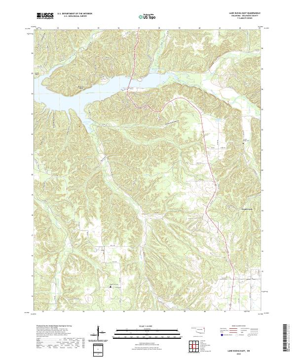
2022 Map of Lake Eucha East
USGS Topo · Published 2022About this map
Lake Eucha dominates this corner of Delaware County, its waters filling the deep valleys of the Ozark Plateau. The reservoir is fed by a network of waterways including Spavinaw Creek, Beaty Cr, and Cloud Cr, creating distinct fingers like Brush Creek Bay and Dry Creek Arm. The surrounding terrain is marked by prominent ridges and named bluffs, such as Lanes Bluff and Black Fox Bluff, which overlook the submerged creek beds.
Find a feature on this map
87 named features on this map. Tap any name to fly to it.
Don’t see what you’re looking for? This feature index may not catch every label — zoom into the map to look around manually.
Map Details
Editions of this 2022 Lake Eucha East Map
This is the sole edition of this map. No revisions or reprints were ever made.
Other maps of this area

1899 · Siloam Springs
USGS Topo · 1:125,000

1903 · Siloam Springs
USGS Topo · 1:125,000

1904 · Siloam Springs
USGS Topo · 1:125,000

1954 · Tulsa
USGS Topo · 1:250,000

1958 · Tulsa
USGS Topo · 1:250,000

1963 · Tulsa
USGS Topo · 1:250,000

1971 · Kenwood
USGS Topo · 1:24,000

1971 · Jay SE
USGS Topo · 1:24,000
1971 · Jay
USGS Topo · 1:24,000
1971 · Sycamore
USGS Topo · 1:24,000