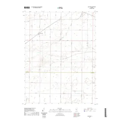
2021 Map of Lake Fork
USGS Topo · Published 2021About this map
The small settlement of Lake Fork serves as a focal point in this central Illinois landscape, situated along the namesake waterway that snakes through the grain-producing plains. This 2021 survey illustrates a region defined by a precise section-line grid of rural roads like 1250th Ave and Co Rd 1300 E, which connect isolated farmsteads across the Logan and Sangamon county line. Local history and genealogy are anchored by several family-named burial grounds, including Carlyle Cem to the north and Bell Cem near the eastern boundary. The presence of Hunter Slough and the winding course of Lake Fork provide a natural contrast to the rigid geometry of the agricultural road network, highlighting the low-lying drainage patterns essential to the area's farming economy.
Find a feature on this map
53 named features on this map. Tap any name to fly to it.
Don’t see what you’re looking for? This feature index may not catch every label — zoom into the map to look around manually.
Map Details
Editions of this 2021 Lake Fork Map
This is the sole edition of this map. No revisions or reprints were ever made.
Other maps of this area

1911 · Lincoln
USGS Topo · 1:62,500

1913 · Lincoln
USGS Topo · 1:62,500

1954 · Niantic
USGS Topo · 1:62,500

1954 · Mechanicsburg
USGS Topo · 1:62,500

1957 · Kenney
USGS Topo · 1:62,500

1958 · Peoria
USGS Topo · 1:250,000

1958 · Decatur
USGS Topo · 1:250,000

1961 · Peoria
USGS Topo · 1:250,000

1961 · Decatur
USGS Topo · 1:250,000

1963 · Peoria
USGS Topo · 1:250,000