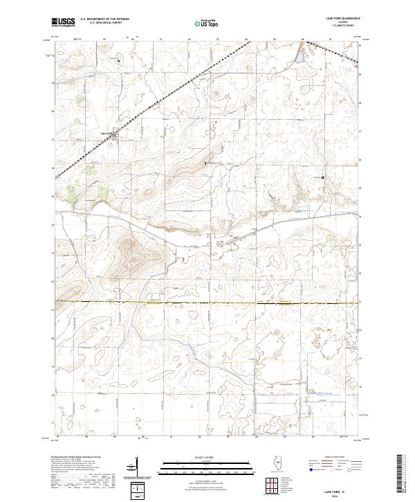
2024 Map of Lake Fork
USGS Topo · Published 2024About this map
Lake Fork centers this landscape in the early 21st century, marking the small settlement and the winding waterway from which it takes its name. The terrain is defined by a dense grid of agricultural roads, including Co Rd 8 and Kent Farm Rd, which cross the fertile plains at the border of Logan Co and Sangamon Co. For genealogists and local historians, the map identifies several rural burial grounds that speak to the area's pioneer heritage, such as Carlyle Cem to the north and Steenberger Cem near the center of the sheet.
Find a feature on this map
50 named features on this map. Tap any name to fly to it.
Don’t see what you’re looking for? This feature index may not catch every label — zoom into the map to look around manually.
Map Details
Editions of this 2024 Lake Fork Map
This is the sole edition of this map. No revisions or reprints were ever made.
Other maps of this area

1911 · Lincoln
USGS Topo · 1:62,500

1913 · Lincoln
USGS Topo · 1:62,500

1954 · Niantic
USGS Topo · 1:62,500

1954 · Mechanicsburg
USGS Topo · 1:62,500

1957 · Kenney
USGS Topo · 1:62,500

1958 · Peoria
USGS Topo · 1:250,000

1958 · Decatur
USGS Topo · 1:250,000

1961 · Peoria
USGS Topo · 1:250,000

1961 · Decatur
USGS Topo · 1:250,000

1963 · Peoria
USGS Topo · 1:250,000