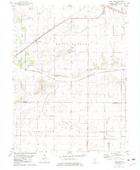
1982 Map of Lake Fork
USGS Topo · Published 1983About this map
The Illinois Central Gulf railroad cuts a diagonal path across this central Illinois landscape, serving the small community of Lake Fork. The area is defined by its agricultural character and the drainage of the namesake Lake Fork and Hunter Slough, which weave through the townships of Mount Pulaski and Lanesville. This 1982 edition captures the transition of the rural landscape in Logan and Sangamon Counties, showing a network of section lines and field boundaries often marked by fences.
Find a feature on this map
19 named features on this map. Tap any name to fly to it.
Don’t see what you’re looking for? This feature index may not catch every label — zoom into the map to look around manually.
Map Details
Editions of this 1982 Lake Fork Map
This is the sole edition of this map. No revisions or reprints were ever made.
Other maps of this area

1911 · Lincoln
USGS Topo · 1:62,500

1913 · Lincoln
USGS Topo · 1:62,500

1954 · Niantic
USGS Topo · 1:62,500

1954 · Mechanicsburg
USGS Topo · 1:62,500

1957 · Kenney
USGS Topo · 1:62,500

1958 · Peoria
USGS Topo · 1:250,000

1958 · Decatur
USGS Topo · 1:250,000

1961 · Peoria
USGS Topo · 1:250,000

1961 · Decatur
USGS Topo · 1:250,000

1963 · Peoria
USGS Topo · 1:250,000