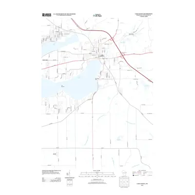
2013 Map of Lake Geneva
USGS Topo · Published 2013About this map
Lake Geneva and Lake Como define the geography of this Walworth County landscape, serving as the central features for the resort community of Lake Geneva. The map captures the dense street grid of the city, transitioning into the sprawling residential developments along the northern shores of the lakes, including the settlement of Como. Notable waterfront landmarks such as Mannings Point, Ceylon Lagoon, and the restrictive passage of The Narrows reflect the area's long-standing identity as a premier glacial lake destination.
Find a feature on this map
112 named features on this map. Tap any name to fly to it.
Don’t see what you’re looking for? This feature index may not catch every label — zoom into the map to look around manually.
Map Details
Editions of this 2013 Lake Geneva Map
This is the sole edition of this map. No revisions or reprints were ever made.
Other maps of this area

1893 · Delavan
USGS Topo · 1:62,500

1893 · Geneva
USGS Topo · 1:62,500

1904 · Lake Geneva
USGS Topo · 1:62,500

1906 · Lake Geneva
USGS Topo · 1:62,500

1926 · Mc Henry
USGS Topo · 1:62,500

1932 · Harvard
USGS Topo · 1:48,000

1937 · Harvard
USGS Topo · 1:62,500

1944 · McHenry
USGS Topo · 1:62,500

1954 · Rockford
USGS Topo · 1:250,000

1955 · Rockford
USGS Topo · 1:250,000