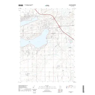
2018 Map of Lake Geneva
USGS Topo · Published 2018About this map
Lake Geneva serves as the central hub of this Walworth County landscape, where the waters of Geneva Bay and Lake Geneva meet near Mannings Point. The settlement pattern reflects a long-standing resort and residential tradition, extending from the shoreline to the northern waters of Lake Como. Inland, the geography is defined by a series of small water bodies and watercourses, including Peterkin Pond and the W Br N Br Nippersink Cr. For those researching local history, the map provides precise locations for several burial grounds, such as Oak Hill Cem, Pioneer Cem, and Old Bloomfield Cem. The presence of the Grand Geneva Resort Airport and an intricate network of local roads like Sheridan Springs Rd and Krueger Rd highlights the area's development into a major regional destination by the early 21st century.
Find a feature on this map
155 named features on this map. Tap any name to fly to it.
Don’t see what you’re looking for? This feature index may not catch every label — zoom into the map to look around manually.
Map Details
Editions of this 2018 Lake Geneva Map
This is the sole edition of this map. No revisions or reprints were ever made.
Other maps of this area

1893 · Delavan
USGS Topo · 1:62,500

1893 · Geneva
USGS Topo · 1:62,500

1904 · Lake Geneva
USGS Topo · 1:62,500

1906 · Lake Geneva
USGS Topo · 1:62,500

1926 · Mc Henry
USGS Topo · 1:62,500

1932 · Harvard
USGS Topo · 1:48,000

1937 · Harvard
USGS Topo · 1:62,500

1944 · McHenry
USGS Topo · 1:62,500

1954 · Rockford
USGS Topo · 1:250,000

1955 · Rockford
USGS Topo · 1:250,000