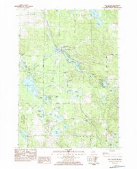
1983 Map of Lake George
USGS Topo · Published 1984About this map
The settlement of Lake George serves as the focal point for this northern Clare County survey, situated at the junction of Lincoln, Redding, and Greenwood townships. The landscape is defined by its glacial hydrology, featuring dozens of named water bodies from the elongated Lake George and Shingle Lake to the scattered Cranberry Lakes and Silver Lake clusters. Human modification of the terrain is evident in the extensive Freeman-Lincoln Gas Storage Field, where infrastructure like the Compressor Station is integrated into the forested and swampy lowlands.
Find a feature on this map
57 named features on this map. Tap any name to fly to it.
Don’t see what you’re looking for? This feature index may not catch every label — zoom into the map to look around manually.
Map Details
Editions of this 1983 Lake George Map
This is the sole edition of this map. No revisions or reprints were ever made.
Other maps of this area

1954 · Traverse City
USGS Topo · 1:250,000

1954 · Midland
USGS Topo · 1:250,000

1957 · Harrison
USGS Topo · 1:62,500

1957 · Marion
USGS Topo · 1:62,500

1958 · Traverse City
USGS Topo · 1:250,000

1958 · Midland
USGS Topo · 1:250,000

1959 · Midland
USGS Topo · 1:250,000

1959 · Lake
USGS Topo · 1:62,500

1959 · Clare
USGS Topo · 1:62,500

1966 · Midland
USGS Topo · 1:250,000