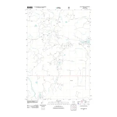
2011 Map of Lake Gordon
USGS Topo · Published 2011About this map
The Peshtigo River meanders through the southwestern corner of this Forest County landscape, anchoring a wilderness area defined by glacial lakes and a complex network of forest service roads. The settlement at Bonneval sits along the southern edge, while the Newald Lookout Tower provides a high-point reference to the north. This 2011 survey highlights the recreational and hydrological character of the region, featuring significant water bodies such as Lake Gordon and Lake Laura, which are serviced by the Laura-Gordon Lakes Campground. Numerous small streams, including Simpson Creek, Hanson Creek, and Haymeadow Creek, drain the heavily timbered terrain. The abundance of forest roads, such as National Forest Road 2386 and Newald Tower Rd, underscores the area's importance for timber management and outdoor access.
Find a feature on this map
43 named features on this map. Tap any name to fly to it.
Don’t see what you’re looking for? This feature index may not catch every label — zoom into the map to look around manually.
Map Details
Editions of this 2011 Lake Gordon Map
This is the sole edition of this map. No revisions or reprints were ever made.
Other maps of this area

1939 · Goodman
USGS Topo · 1:48,000

1939 · Laona
USGS Topo · 1:48,000

1939 · Long Lake
USGS Topo · 1:48,000

1941 · Florence
USGS Topo · 1:48,000

1946 · Laona
USGS Topo · 1:48,000

1946 · Goodman
USGS Topo · 1:48,000

1948 · Long Lake
USGS Topo · 1:48,000

1954 · Iron Mountain
USGS Topo · 1:250,000

1959 · Iron Mountain
USGS Topo · 1:250,000
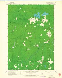
1962 · Florence SW
USGS Topo · 1:24,000