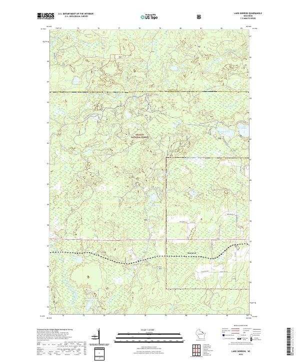
2022 Map of Lake Gordon
USGS Topo · Published 2022About this map
Nicolet National Forest encompasses the vast majority of this landscape, characterized by a dense network of glacial lakes and wetlands across the Florence and Forest County line. The settlement of Bonneval serves as a small point of orientation in the southeastern portion of the map, surrounded by a grid of family-named local roads such as Wozniak Rd, Pawlowski Ln, and Ziolkowski Rd. These names reflect the local heritage and the long-term settlement patterns of this timber-rich region.
Find a feature on this map
40 named features on this map. Tap any name to fly to it.
Don’t see what you’re looking for? This feature index may not catch every label — zoom into the map to look around manually.
Map Details
Editions of this 2022 Lake Gordon Map
This is the sole edition of this map. No revisions or reprints were ever made.
Other maps of this area

1939 · Goodman
USGS Topo · 1:48,000

1939 · Laona
USGS Topo · 1:48,000

1939 · Long Lake
USGS Topo · 1:48,000

1941 · Florence
USGS Topo · 1:48,000

1946 · Laona
USGS Topo · 1:48,000

1946 · Goodman
USGS Topo · 1:48,000

1948 · Long Lake
USGS Topo · 1:48,000

1954 · Iron Mountain
USGS Topo · 1:250,000

1959 · Iron Mountain
USGS Topo · 1:250,000
1962 · Florence SW
USGS Topo · 1:24,000