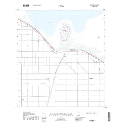
2018 Map of Lake Harbor
USGS Topo · Published 2018About this map
Lake Harbor and the southern rim of Lake Okeechobee anchor this 2018 survey of the Florida Everglades' northern agricultural frontier. The landscape is defined by the rigid geometry of drainage and transport, where the Miami Canal cuts south through a grid of large-scale farm plots and industrial roads. Settlements like Bean City, Mott, and Watson line the primary transit corridors of Old US Hwy 27 and Corkscrew Blvd, tracing the historical footprint of land reclamation and sugarcane cultivation in Palm Beach County. Just offshore, the marshy expanse of South Bay reveals Ritta Island and Halifax Banks Island, while the Florida National Scenic Trail winds along the levee system. This map illustrates the intersection of modern South Florida water management and the enduring rural communities that emerged from the muck lands over the last century.
Find a feature on this map
23 named features on this map. Tap any name to fly to it.
Don’t see what you’re looking for? This feature index may not catch every label — zoom into the map to look around manually.
Map Details
Editions of this 2018 Lake Harbor Map
This is the sole edition of this map. No revisions or reprints were ever made.
Other maps of this area

1956 · West Palm Beach
USGS Topo · 1:250,000

1957 · West Palm Beach
USGS Topo · 1:250,000

1958 · West Palm Beach
USGS Topo · 1:250,000

1970 · Lake Harbor
USGS Topo · 1:24,000

1970 · Belle Glade
USGS Topo · 1:24,000

1970 · Lake Harbor SE
USGS Topo · 1:24,000

1970 · Lake Harbor SW
USGS Topo · 1:24,000

1970 · Clewiston South
USGS Topo · 1:24,000

1970 · Okeelanta
USGS Topo · 1:24,000

1970 · Pahokee
USGS Topo · 1:24,000