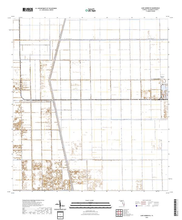
2024 Map of Lake Harbor SE
USGS Topo · Published 2024About this map
The Miami Canal and Bolles Canal intersect in this corner of the Everglades, defining the agricultural geometry of Palm Beach County. The landscape is dominated by a vast grid of drainage and irrigation infrastructure, a hallmark of the region's mid-20th-century transformation into a major sugar and winter vegetable production hub. Transportation follows these waterways, with Miami Canal Rd and Bolles Canal Rd tracing the embankments to serve the industrial farms. Near the eastern edge, the Okeelanta Airport stands as a focal point for the specialized aviation needs of large-scale agriculture. This survey captures the highly engineered nature of the South Florida interior, where water management systems dictate the placement of every road and boundary.
Find a feature on this map
11 named features on this map. Tap any name to fly to it.
Don’t see what you’re looking for? This feature index may not catch every label — zoom into the map to look around manually.
Map Details
Editions of this 2024 Lake Harbor SE Map
This is the sole edition of this map. No revisions or reprints were ever made.
Other maps of this area

1956 · West Palm Beach
USGS Topo · 1:250,000

1957 · West Palm Beach
USGS Topo · 1:250,000

1958 · West Palm Beach
USGS Topo · 1:250,000

1970 · Lake Harbor
USGS Topo · 1:24,000

1970 · Belle Glade
USGS Topo · 1:24,000

1970 · Lake Harbor SE
USGS Topo · 1:24,000

1970 · Lake Harbor SW
USGS Topo · 1:24,000

1970 · Clewiston South
USGS Topo · 1:24,000

1970 · Okeelanta
USGS Topo · 1:24,000

1974 · Everglades 1 NW
USGS Topo · 1:24,000