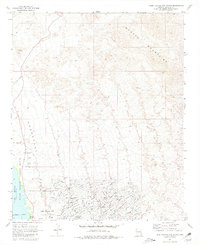
1970 Map of Lake Havasu City North
USGS Topo · Published 1981About this map
The master-planned community of Lake Havasu City is seen here during its formative years of expansion following its mid-1960s founding. The residential street grid, including major thoroughfares like Smoketree Avenue and Palo Verde Avenue, fans out from the eastern shores of Lake Havasu. This urban development contrasts sharply with the protected natural areas of the Havasu National Wildlife Refuge and the Lake Havasu State Park, which line the waterfront.
Find a feature on this map
58 named features on this map. Tap any name to fly to it.
Don’t see what you’re looking for? This feature index may not catch every label — zoom into the map to look around manually.
Map Details
Editions of this 1970 Lake Havasu City North Map
4 editions found
Other maps of this area

1903 · Needles
USGS Topo · 1:125,000

1904 · Needles Special
USGS Topo · 1:125,000

1911 · Parker
USGS Topo · 1:125,000

1927 · Buck Mountains
USGS Topo · 1:62,500

1929 · Buck Mountains
USGS Topo · 1:62,500

1943 · Giers Basin
USGS Topo · 1:62,500

1943 · Topock
USGS Topo · 1:62,500

1943 · Whipple Mts.
USGS Topo · 1:62,500

1950 · Topock
USGS Topo · 1:62,500

1950 · Whipple Mts
USGS Topo · 1:62,500