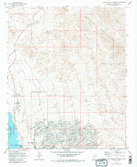
1970 Map of Lake Havasu City North
USGS Topo · Published 1987About this map
The burgeoning desert community of Lake Havasu City is the central focus of this 1970 survey, captured during a period of rapid residential expansion following the city's incorporation. The map details an extensive network of planned residential streets such as Palo Verde Blvd and Kiowa Blvd, carving into the arid landscape of the Chemehuevi Valley. To the west, the waters of Lake Havasu and the protected lands of the Havasu National Wildlife Refuge provide a sharp contrast to the development.
Find a feature on this map
34 named features on this map. Tap any name to fly to it.
Don’t see what you’re looking for? This feature index may not catch every label — zoom into the map to look around manually.
Map Details
Editions of this 1970 Lake Havasu City North Map
4 editions found
Other maps of this area

1903 · Needles
USGS Topo · 1:125,000

1904 · Needles Special
USGS Topo · 1:125,000

1911 · Parker
USGS Topo · 1:125,000

1927 · Buck Mountains
USGS Topo · 1:62,500

1929 · Buck Mountains
USGS Topo · 1:62,500

1943 · Giers Basin
USGS Topo · 1:62,500

1943 · Topock
USGS Topo · 1:62,500

1943 · Whipple Mts.
USGS Topo · 1:62,500

1950 · Topock
USGS Topo · 1:62,500

1950 · Whipple Mts
USGS Topo · 1:62,500