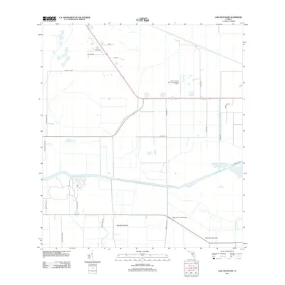
2012 Map of Lake Hicpochee
USGS Topo · Published 2012About this map
Lake Hicpochee and the Caloosahatchee Canal dominate this landscape in Hendry County, reflecting the region's managed hydrology and agricultural layout. The map reveals a transition from natural features like Beautiful Hammock and Woodyard Hammock to a grid of rural infrastructure, including the Negro Jim Hammock Bridge and the Graham Landing Strip - Moore Haven Airport. Named locales such as Storey and Peeples suggest early landholding and small-scale settlement patterns centered near Donald Peeples Pond.
Find a feature on this map
23 named features on this map. Tap any name to fly to it.
Don’t see what you’re looking for? This feature index may not catch every label — zoom into the map to look around manually.
Map Details
Editions of this 2012 Lake Hicpochee Map
This is the sole edition of this map. No revisions or reprints were ever made.
Other maps of this area

1956 · West Palm Beach
USGS Topo · 1:250,000

1957 · West Palm Beach
USGS Topo · 1:250,000

1958 · West Palm Beach
USGS Topo · 1:250,000

1958 · Goodno
USGS Topo · 1:24,000

1958 · Felda NE
USGS Topo · 1:24,000
1958 · Palmdale
USGS Topo · 1:24,000

1970 · Moore Haven
USGS Topo · 1:24,000
1970 · Lakeport
USGS Topo · 1:24,000

1970 · La Belle 4 NW
USGS Topo · 1:24,000

1970 · La Belle 4 NE
USGS Topo · 1:24,000