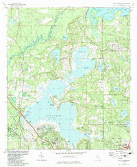
1982 Map of Lake Jackson
USGS Topo · Published 1983About this map
Lake Jackson and its surrounding wetlands dominate this 1980s landscape, illustrating the suburban expansion north of Tallahassee. The presence of the Lake Jackson Mounds State Archaeological Site on the southern shore highlights the long-standing significance of this basin, while residential developments like Harbinwood Estates and Bellwood Estates reflect the modern growth of the era. The terrain is characterized by numerous water bodies including Orchard Pond, Mallard Pond, and Carr Lake, connected by a network of boat ramps and landings such as Bull Headley Public Landing.
Find a feature on this map
59 named features on this map. Tap any name to fly to it.
Don’t see what you’re looking for? This feature index may not catch every label — zoom into the map to look around manually.
Map Details
Editions of this 1982 Lake Jackson Map
2 editions found
Other maps of this area

1940 · Tallahassee
USGS Topo · 1:62,500

1942 · Tallahassee
USGS Topo · 1:62,500

1943 · Tallahassee
USGS Topo · 1:62,500

1954 · Lafayette
USGS Topo · 1:24,000

1954 · Tallahassee
USGS Topo · 1:250,000

1956 · Havana North
USGS Topo · 1:24,000

1956 · Calvary
USGS Topo · 1:24,000

1957 · Beachton
USGS Topo · 1:24,000

1959 · Tallahassee
USGS Topo · 1:250,000

1960 · Tallahassee
USGS Topo · 1:250,000