
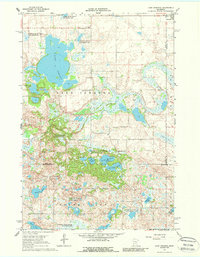
1967 Map of Lake Johanna
USGS Topo · Published 1968About this map
The glacial pothole landscape of central Minnesota is on full display here, characterized by a dense network of water bodies and conservation lands at the intersection of Pope, Stearns, and Kandiyohi counties. The large, central expanse of Lake Johanna is surrounded by numerous smaller basins including Kittleson Lake, Brenner Lake, and Rocky Mountain Lake. A significant portion of the terrain is dedicated to conservation, with boundaries for the Bangor State Wildlife Management Area, Skarpness State Wildlife Management Area, and Little Jo State Wildlife Management Area protecting the wetland habitats. Local history is anchored by the South Lake Johanna Ch and an adjacent Cem, while the village of Brooten touches the northeastern corner. In the south, the map captures the upper reaches of Norway Lake and the Oleander State Wildlife Management Area, showing a rural landscape where wildlife management and agriculture coexist.
Find a feature on this map
27 named features on this map. Tap any name to fly to it.
Don’t see what you’re looking for? This feature index may not catch every label — zoom into the map to look around manually.
Map Details
Editions of this 1967 Lake Johanna Map
2 editions found
Other maps of this area

1953 · Saint Cloud
USGS Topo · 1:250,000

1957 · Saint Cloud
USGS Topo · 1:250,000

1958 · Saint Cloud
USGS Topo · 1:250,000

1965 · Padua
USGS Topo · 1:24,000

1965 · Sedan
USGS Topo · 1:24,000

1967 · Mount Tom
USGS Topo · 1:24,000

1967 · Sunburg
USGS Topo · 1:24,000

1967 · Belgrade
USGS Topo · 1:24,000

1968 · Terrace
USGS Topo · 1:24,000

1968 · Lake Simon
USGS Topo · 1:24,000