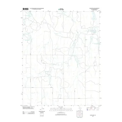
2012 Map of Lake June
USGS Topo · Published 2012About this map
Cataline Cem serves as a small but significant historical marker in this rural Hemphill County landscape, where the upper reaches of the Washita River and its various tributaries define the geography. The area is characterized by a sophisticated network of water management features, including the Soil Conservation Service Site 15 Reservoir and several other numbered sites designed for erosion control and water storage. These reservoirs, alongside Lake June and Lake Sharon, illustrate the mid-to-late 20th-century effort to stabilize the watershed of the Dry Fork Washita River and Gageby Cr. Local transport relies on a grid of rural routes such as Ranch Road 3303 and FM-277, which connect the scattered water bodies and agricultural lands in this part of the Texas Panhandle.
Find a feature on this map
27 named features on this map. Tap any name to fly to it.
Don’t see what you’re looking for? This feature index may not catch every label — zoom into the map to look around manually.
Map Details
Editions of this 2012 Lake June Map
This is the sole edition of this map. No revisions or reprints were ever made.
Other maps of this area

1954 · Amarillo
USGS Topo · 1:250,000

1958 · Amarillo
USGS Topo · 1:250,000

1963 · Allison
USGS Topo · 1:24,000

1963 · Briscoe
USGS Topo · 1:24,000

1963 · Allison SW
USGS Topo · 1:24,000

1967 · Dads Creek
USGS Topo · 1:24,000

1967 · Gem
USGS Topo · 1:24,000

1967 · Hackberry Creek
USGS Topo · 1:24,000

1967 · Lake June
USGS Topo · 1:24,000

1967 · Blue Ridge School
USGS Topo · 1:24,000