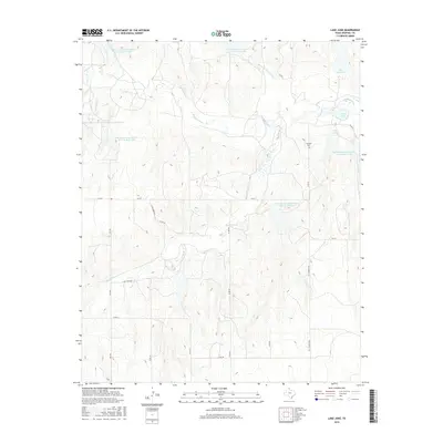
2016 Map of Lake June
USGS Topo · Published 2016About this map
The Washita River and its various tributaries define this section of the Texas Panhandle in Hemphill County. Water management is a central theme of the landscape, illustrated by numerous numbered reservoirs such as Soil Conservation Service Site 13 Reservoir and Soil Conservation Service Site 25 Reservoir. These man-made features support a region characterized by ranching and rural infrastructure, where local life is tied to the movement of water through Gageby Cr and the Dry Fork Washita River. Cultural landmarks provide essential touchstones for family historians, including the Elam Cemetery located near the center of the quadrangle and Cataline Cem further east. The map also records localized place names like Jeff Puryear, reflecting the personal history of land ownership in this part of the state.
Find a feature on this map
30 named features on this map. Tap any name to fly to it.
Don’t see what you’re looking for? This feature index may not catch every label — zoom into the map to look around manually.
Map Details
Editions of this 2016 Lake June Map
This is the sole edition of this map. No revisions or reprints were ever made.
Other maps of this area

1954 · Amarillo
USGS Topo · 1:250,000

1958 · Amarillo
USGS Topo · 1:250,000

1963 · Allison
USGS Topo · 1:24,000

1963 · Briscoe
USGS Topo · 1:24,000

1963 · Allison SW
USGS Topo · 1:24,000

1967 · Dads Creek
USGS Topo · 1:24,000

1967 · Gem
USGS Topo · 1:24,000

1967 · Hackberry Creek
USGS Topo · 1:24,000

1967 · Lake June
USGS Topo · 1:24,000

1967 · Blue Ridge School
USGS Topo · 1:24,000